 |
|
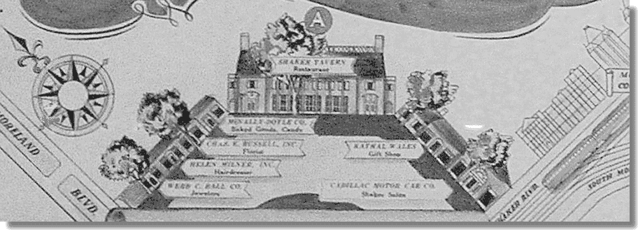
Hanging on a wall in one of
the exhibit rooms at the Shaker
Historical Society is a map of Shaker Square. It includes
the names of every business on the Square, even
the second floor tenants.
We know the
undated map is pre-1937 because it says "site of
proposed theater" where the Colony Theater would
built in 1937. Our guess is that it was published in
1936.
It's about the
size of a newspaper page, and it may have been
published as a full-page ad. |
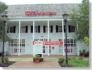
We show only the Northeast
Quadrant above. The building that is CVS today was then
Shaker Tavern. Where Sergio's Saravá is located was
then a
Cadillac dealership. Where you enjoy a
cup of coffee - Deweys - was then Webb C. Ball,
perhaps Cleveland's finest jeweler of the day.
The Rapid ran along Shaker
Boulevard then, but not on Van Aken Boulevard, then called
South Moreland. (Today's South Moreland was then East 132nd
Street.)
To see the whole map and much more, and go back in
time, even back to the days of the North Union Shakers from
whom Shaker Heights got its name, go to the Shaker Historical Society at 16740 South
Park Blvd, east of Lee Road.
To learn more, visit the website of
the
Shaker Historical Society. |