v
|
|
|
|
| Getting Here | |||||
|
|
|||||
|
|||||
|
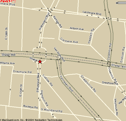
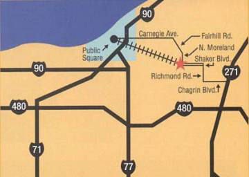
Parking meters all around the Square and on
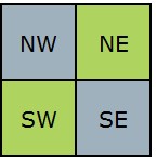
Shaker Boulevard. The Square is in four quadrants, divided by Shaker Boulevard and North and South Moreland Boulevards. West is towards downtown. East is towards Shaker Heights.
Driving Here You can navigate using the address of your destination, but be aware that computer-generated routes to Shaker Square are not always the best. Our suggested route from downtown, because it is a divided road with only a few crossing streets and traffic lights, is Chester Avenue.
Another route, but with two-way traffic and more crossing streets, is via Carnegie Avenue.
Coming from the east, we suggest using
Shaker Boulevard. Riding the Shaker Rapid
Transit
Our electric-powered light rail line (locals call it "the Rapid") is a reminder of an earlier time when streetcars (trolleys) were how residents of Cleveland and its inner-ring suburbs traveled, and when light rail lines connected northeast Ohio's cities and towns. Going west (towards downtown) the Blue Line Rapid from Van Aken near Chagrin Road stops here, as does the Green Line whose start at Shaker Boulevard and Green Road has a free parking lot. Both lines end downtown, in Tower City. You can continue west on another RTA line all the way to our Cleveland-Hopkins Airport. Coming east from downtown (Tower City) take either the Blue or Green Line. Both stop at the Square. The Blue Line then goes southeast on Van Aken; the Green Line continues east on Shaker Boulevard ending at Green Road.
For more,
visit the RTA website.
|
 |
|
|