How Shaker's western neighborhoods were lost

1910 map of the area


Source: Forman-Bassett-Hatch Company Map of Cleveland and Vicinity 1910  
See map online at www.RailsandTrails.com (DjVu software required)

Map Legend:
wide red line = Cleveland city limit (as of 1910)
- - - - -  village or township limits (as of 1910)
green lines = streetcar routes
red arcs indicate miles from the center of Cleveland
Today East Blvd is Martin Luther King Drive
Symbols: (added)
 C = By September 1912 this area had been annexed to Cleveland
 
R = Rice Elementary School at Buckeye and East 116th
 
V = Van Aken home. on East 128th Street, in Shaker Heights
 
S = Shaker Square future location. In 1912 it was farm land in Newburg City.
 
B = Boulevard School, to be opened in 1913. (Coventry Road became Shaker Blvd)

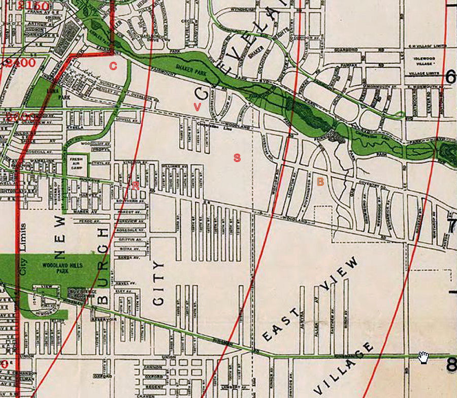
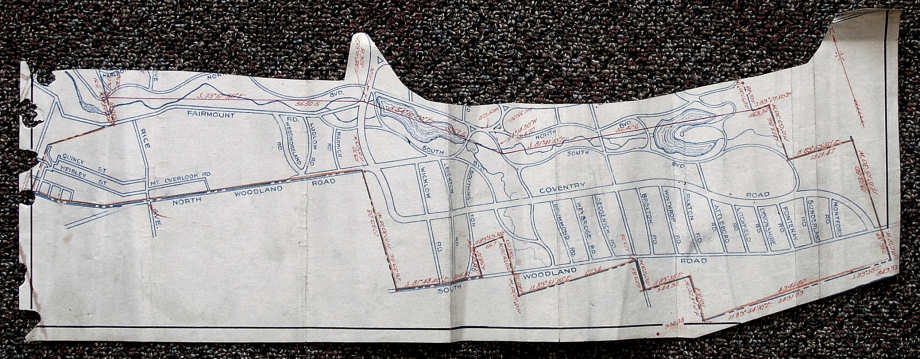
Map of the original Shaker Village - June 1911

This map was found in the Cuyahoga County Archives, in the same file box as the 1911 petition that carved a new Shaker Village out of Cleveland Heights Village. Though the map is not dated nor attached to the 1911 petition, the red text that notes direction and distance is the same as the petition's legal description of the area. See the 1911 petition

Shaker Village's complex shape was a result of following the boundaries of Cleveland Heights. Its western border was the Cleveland city line, then east of the Baldwin Reservoir. In the southwest, it ended at the Newburg City line - North Woodland Road (now Larchmere Boulevard) and in the south and southeast, Shaker Village ended at East View Village.

The first map on this page was drawn in 1910 and shows those borders more clearly. It also shows the densely populated Woodland neighborhood in the west, where nearly all residents of the new village lived. See "GG" in the last map on this page.

To learn more about those who lived in the original Shaker Village, click here.


June 1911 map of Shaker Village  photographed at the Cuyahoga County Archives

        
Western parts of Shaker Township are annexed to Cleveland: 1912, 1915

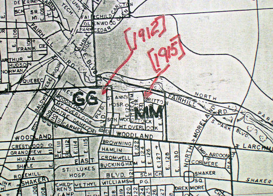
On display in the Cleveland City Council Archives is a current map that shows how Cleveland grew over the years by annexing adjacent communities. This  portion of that map shows how in two steps, the westernmost parts of the original Shaker Village became part of the City of Cleveland.


Map photographed at the Cleveland City Council Archives,

Moving west to east:

  • GG - in June 1911 the streets around Ingersoll (now Mt. Carmel) and Mt. Overlook were the westernmost part of Shaker Village. Their residents accounted for a large share of the signatures on the 1911 petition. But only three months later, when the trustees of Shaker Village started an initiative to become Shaker Heights Village, they left area GG behind. Voters in GG soon asked that their area be annexed to Cleveland. It was annexed in 1912.
     

  • MM - in September 1912 the Shaker Heights Board of Education transferred area "MM", now its westernmost neighborhood, to the Cleveland schools. In return the Shaker Heights schools received the area around Shaker Square. [Learn more about this exchange of school areas.] That didn't change any municipal boundaries. But with the early 1913 annexations to Cleveland of "GG" to the west and Newburgh City to the south, area "MM" was now next to Cleveland and could apply for annexation. On June 23, 1913 its voters petitioned Cleveland to be annexed. After an unusually long delay of 20 months, in early 1915 "MM" became part of Cleveland.

That left the northwest border of Shaker Heights as it is today.

Our pages include the 1910 U. S. Cenus information for these neighborhoods

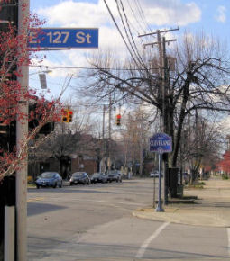
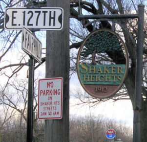
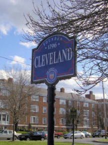
The Shaker Heights - Cleveland border today

Drive east on Larchmere Road. At East 127th Street you'll see a Cleveland sign on the right (north) side past East 127th.

Turn right. Go north on East 127th to Fairhill Road (Fairmount Road on old maps). You'll see a Shaker Heights sign on the right.

Then proceed east on Fairhill. Turn right at Kemper. Just south of Larchmere you'll see another Cleveland sign, plus signs for Shaker Square. 

The area around the circle that would become Shaker Square is still in Cleveland and in the Shaker schools, pursuant to the "swap" made in September 1912 by the Boards of Education of Cleveland and of Shaker Heights Village.

a "Welcome to Cleveland" sign "Welcome to Shaker Heights"

"Welcome to Cleveland"

Larchmere Blvd, at East 127th
 looking west
Fairhill Road at East 127th
looking east
Larchmere and North Moreland,
looking south

Thanks to Cuyahoga County Archivist Judith Cetina PhD, Cleveland City Council Archivist
Martin Hauserman and Virginia Dawson PhD for their help.

top of page     Founding of Shaker Heights    Shaker Square Home